Before Street Signs, How Did People Name a Place?
Before street signs, shared place names tied meeting points to landmarks, trades, and routes, helping people describe where to go without a printed address.
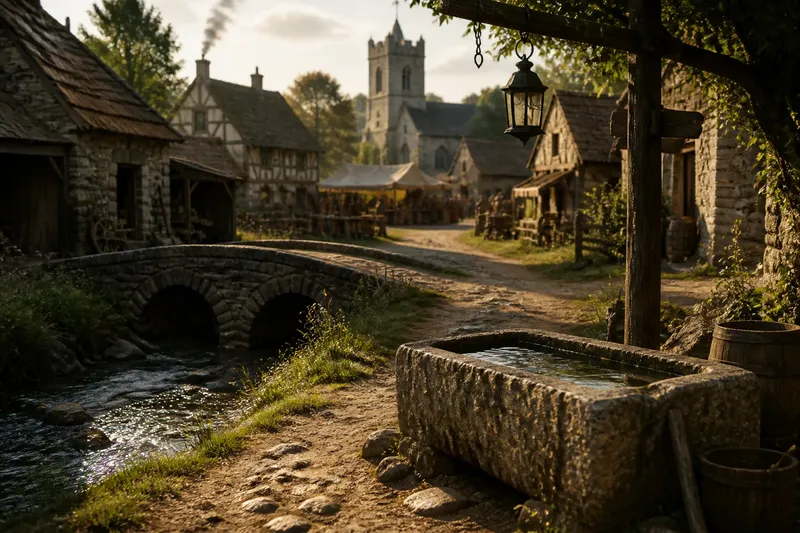
Before street signs, how did people name a place? They called it what other people could recognize: the mill, the well, the bend, or the path behind the market. Before street signs, place names worked as spoken directions, built from familiar features and repeated in ordinary conversation.
There was no single naming system for every town or period. A name might be temporary, local, and different from the one used by travelers. But several practical habits made places easier to identify and meetings easier to arrange.
Landmarks Became Shortcuts
A prominent object could stand in for a location. A church tower, bridge, large tree, spring, or distinctive rock gave people a visible point of reference, especially when nearby lanes had no signs or formal addresses.
Such names were useful because they compressed a longer description. “Meet by the bridge” could be clearer than a string of turns, provided both people knew which bridge mattered. A landmark name might also cover the space around it rather than the object alone: the crossing, the bank, and a nearby patch of ground could all be understood through the same reference.
Names could shift as the landscape changed. If a tree came down or a bridge was replaced, people might keep the old name for a while, alter it, or adopt a new one. Spoken geography did not need an official announcement to adapt; repetition did much of the work.
Trades Marked Familiar Ground
Workplaces supplied another durable set of names. A smithy, pottery, ferry landing, market stall, or cluster of workshops could identify a place more reliably than a natural feature that was hard to distinguish from a distance.
Trade names often described activity as well as location. Saying “at the tannery” pointed toward a building, but also toward the kind of work people expected there. A name tied to a shop or craft could remain useful to residents who had never entered the premises. It belonged to the shared map, not just to its owner.
These labels could become imprecise as businesses moved or disappeared. People might continue using a former workshop’s name because it still directed a listener to the right corner. That persistence is not necessarily confusion; it is a practical arrangement between memory and space.
Routes Supplied Their Own Names
Paths and crossings were often described by where they led or what they connected. A lane toward the river, a road to the pasture, or a route over a ridge could be identified through its destination, even if nobody had agreed on a formal street name.
For a traveler, route-based names gave direction and orientation at once. “Take the road toward the mill” identifies a way to go and hints at the next recognizable point. For a resident, the same phrase could distinguish one track from several similar ones without requiring a map.
Routes also helped people describe less sharply bounded places. A turn, gate, fork, or stretch of road could anchor a meeting point. The name might refer not to a surveyed parcel but to the spot where people ordinarily paused, waited, or changed direction.
Repeated Use Made Names Shared
A useful name had to travel from one speaker to another. A person could introduce a description, but it became a shared place name only when listeners understood it and began using it themselves. Conversation was the naming system’s distribution network, with all the reliability of conversation and none of its paperwork.
Names could vary between groups. Merchants might use a workshop’s name, while neighbors used a nearby well or a family’s name for the same area. Visitors might know a crossing by its destination. These versions did not always compete: each could work within the circle of people who shared its references.
Say you are arranging to meet a friend in an unnamed settlement. You agree to meet beside the stone trough where the path from the market reaches the stream, and use “the trough” in later directions. If both of you recognize the feature, the phrase gives you a workable meeting place; if it is hidden from newcomers, you add the route that leads to it. The name is useful because it is shared, not because it is official.
Names Had Different Reach
Some spoken names described a tiny point; others covered a broad district. A particular doorway could be an exact rendezvous, while “the lower fields” might help explain a general direction. The scale depended on the conversation and on what the listener needed to find.
This flexibility had limits. A name could be ambiguous if several places shared the same feature, or if a landmark was familiar only to one group. Speakers could resolve that by adding a trade, a route, or another nearby reference: the bridge by the market rather than simply the bridge.
Informal naming therefore did not mean that every place was easy to locate. It meant people could combine familiar clues and adjust their description as needed. A precise meeting point might take more words than a broad destination, but both could belong to the same spoken geography.
Names Outlasted Their Uses
Once repeated, a name could survive the feature that first inspired it. A former market, workshop, or crossing might leave its label in everyday speech after its original purpose had faded. Later residents could inherit the name without knowing its first explanation.
This can make an old place name feel like a fragment of an earlier map. It may preserve a trade, route, or landmark that no longer shapes the street in an obvious way. The name remains informative, but it does not always provide a complete account of what once stood there.
For anyone reading a city through its place names, the useful question is not only “What does this name mean?” Ask also what people could see, do, or reach from the place it described. Before street signs, names joined landmarks, trades, and routes into directions people could pass along. That practical question still helps separate a name’s likely everyday use from a more decorative guess.