Why Some Streets Meet at Angles
Why streets meet at angles becomes clearer on a map: read terrain, inherited routes, and later planning to see what shaped a junction.

Why streets meet at angles is easier to see when a map is treated as a record of decisions, not a diagram drawn all at once. One road may follow a ridge, another may preserve a path to a market, and a later street may cut across both. Their meeting point keeps the evidence in view, even after the reason for it has faded from local memory.
An angled junction is not automatically a mistake or a sign that a neighborhood was planned carelessly. Streets inherit alignments from different periods and purposes. The useful question is not simply why the roads fail to form a neat grid, but what each one appears to be following.
More than one street plan
A regular grid is easy to recognize because its streets repeat a small set of directions. That pattern can be laid out deliberately on relatively open ground. But a city is rarely built on an empty sheet. Paths, property lines, waterways, slopes, and existing roads may already organize movement before a formal plan arrives.
When a later planner extends a grid into an area with established routes, the two systems may meet obliquely. One street keeps its earlier direction; the new streets hold to a chosen alignment. At the boundary, blocks can narrow into wedges, corners become acute, and intersections look as if one plan has interrupted another. Often, that is approximately what happened.
Not every angled meeting marks a clear boundary between old and new. A road may have shifted gradually, or several small adjustments may have accumulated over time. Still, a change in street direction is a useful clue: it invites you to look for the route, feature, or property pattern that might have constrained the layout.
Routes that outlast their purpose
Before a road appears as a straight line on a planning map, it may have served as a footpath, farm lane, approach to a settlement, or connection between useful destinations. The route’s original purpose can disappear while its alignment survives in the street network.
Such routes often favor directness between places rather than consistency with a later grid. A path that connected a landing place to a town center, for instance, might cross a set of planned blocks at an angle. The route could remain important enough to pave and widen without being redirected. Later streets then meet it where they can, producing a sequence of irregular junctions.
Older routes are not always the crooked ones. A street that looks unusually straight may have been set out to connect distant points, while the surrounding lanes follow property edges or terrain. Nor does a winding road necessarily preserve an ancient path. The shape alone cannot establish a date or origin; it only suggests a question to test against other visible clues.
On a map, follow the line beyond the junction. Does it continue toward a river crossing, a rail station, a hilltop, a civic center, or the edge of the built-up area? Does it keep the same bearing across several neighborhoods? A longer, coherent alignment is more suggestive of a through-route than a short diagonal that ends at a block corner. It is evidence, not a certificate of age.
Terrain in the street grid
Ground can make a tidy grid awkward or costly. Streets may bend to avoid steep slopes, follow a ridge, stay near a level contour, or reach a workable crossing over water. Even modest changes in elevation can affect where a street can run comfortably, particularly where the surrounding land rises sharply or drainage channels divide the area.
Topographic maps make these possibilities easier to inspect. Closely spaced contour lines indicate steeper ground; broad spacing indicates gentler slopes. If a street’s direction changes near a steep hillside, ravine, or stream valley, the terrain may help explain the alignment. A route crossing the contours at an angle might have been chosen to moderate the climb, while a street following a contour may appear to trace the side of a slope.
Those are patterns to examine, not universal rules. A road may cross a hillside directly because it leads to a specific destination, and a stream may have been rerouted or covered. Current terrain maps can also conceal changes made during construction. The map offers a way to form a plausible reading, but the junction itself does not tell the whole story.
Water deserves a close look because it affects both the route and the crossing. A street may approach a bridge, ford, or narrow gap at an angle that suits the crossing, while later roads approach from the directions their blocks permit. On a contemporary map, the watercourse may be hidden beneath a road or a line of buildings. A visible bend in the street, a park corridor, or a drainage channel may provide a hint.
When planning meets inheritance
Formal planning can introduce a new alignment without erasing the older network. A subdivision might continue streets at a consistent angle, while a later extension meets a preexisting road that runs in another direction. Developers and public authorities may also work around boundaries, buildings, or routes already in use, especially where replacing them would require major changes.
The result can look less like a single plan than a negotiation. A diagonal avenue may pass through several blocks, while side streets remain square to the local grid. At the edge of a district, the avenue could meet a road that predates the subdivision. The intersection’s shape records the fact that the street systems were not designed as one continuous composition.
Planners sometimes use angled streets intentionally, too. A diagonal route can connect destinations more directly than a grid street, create a broad approach to a civic or commercial center, or make a boundary between districts legible. In these cases, the geometry may be part of a later plan rather than an inheritance from an older path.
One useful distinction is whether the angle persists. If the diagonal continues across multiple blocks and connects meaningful destinations, it may function as a planned corridor or established through-route. If it appears only at one intersection, a local constraint or later adjustment may be more likely. Neither pattern proves intent, but continuity helps separate a street’s broader role from the shape of a single corner.
Reading an angled junction
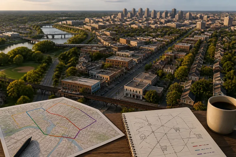
A simple map-reading method begins with the junction and expands outward. Use a street map for the overall pattern, then compare it with a topographic map or satellite view where available. The point is not to solve a city’s full planning history from a screen; it is to identify which explanation fits the visible layout best.
- Trace both streets. Follow each line past the immediate intersection. A route that continues toward a crossing or center may have a different role from a short local street.
- Look for a change in grid direction. Notice whether nearby blocks share one alignment and the angled street preserves another. A consistent boundary can mark the meeting of distinct layouts.
- Check the landform. Compare the street with slopes, ridges, streams, and valleys. Ask whether the alignment follows or avoids a feature rather than assuming the terrain dictated it.
- Notice what lies at the ends. A station, bridge, waterfront, or civic center can help explain why a route keeps its bearing. A destination is a clue to function, not proof of the street’s origin.
- Compare more than one map view. A topographic map can show elevation that a street map omits, while a satellite view can reveal gaps, parks, or water corridors. Each view answers a different question.
Say you notice a diagonal street meeting a neat grid near a creek. You trace it on the street map and see that it continues toward a bridge, then compare the area with a topographic map that shows the creek valley and steeper ground nearby. The expected result is not a certain history but a more disciplined reading: the bridge route and terrain are plausible constraints, while the regular blocks appear to belong to a separate layout.
That distinction matters. A map can support a strong interpretation without revealing who made a decision or when. If the question calls for a documented history, municipal plans, property records, or local archives may be needed. For reading the street pattern itself, careful comparison is usually enough to distinguish visible clues from confident-sounding guesswork.
What does the angle suggest?
Does an angled street mean the neighborhood is older?
Not necessarily. An unusual alignment can preserve an earlier route, but it can also result from later planning, terrain, or property boundaries. Look for supporting clues across nearby blocks before assigning an age.
Can a map show whether terrain shaped a road?
It can show whether a route aligns with slopes, ridges, or a watercourse, especially when you compare a street map with a topographic map. That relationship makes terrain a plausible factor, but it does not establish the original decision by itself.
Why do diagonal roads sometimes end at a grid?
A diagonal road may have been built for a destination or retained from a different street system, while the surrounding grid followed another plan. Its apparent endpoint can mark where that alignment was not extended, rather than where the route ceased to matter.
Are angled intersections always less orderly?
They can be awkward for crossings or block shapes, but their geometry may reflect a route’s purpose or a constraint that a regular grid could not accommodate. Order depends on what the street system needs to connect, not only on whether its corners are square.
The city in the junction
Why streets meet at angles often has more than one answer. Inherited paths, difficult ground, water crossings, and later planning can overlap at a single corner. The map becomes more informative when each street is read as a line with its own direction and possible purpose, rather than as one piece of a uniform grid.
Next time an intersection looks oddly aligned, follow each street beyond it before deciding what it means. The most useful clue may be a bridge several blocks away, a hillside the map nearly hides, or a grid that stops just short of an older route. Even an awkward corner can make a city’s layers easier to read.